Challenge Accepted: 9 Most Challenging Hikes in Ontario's Highlands
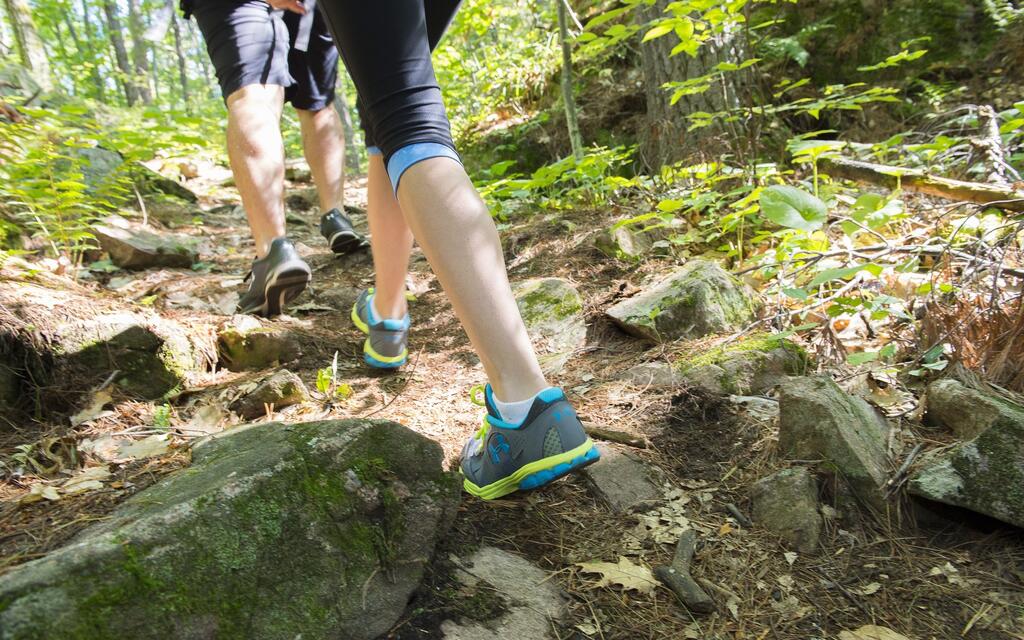
There are some who like to meander over a level trail, taking the time to stop and smell the flowers, to bask in the beauty and marvels of nature. Then there are those who live to push themselves farther, faster, and harder, to reach new heights and work up a sweat on the trail.
In Ontario’s Highlands, the “highlands” part of the name tells you we have plenty of amazing and strenuous hikes to add to your bucket list.
For those of you who love a challenge…this one’s for you.
Wear sturdy shoes or hiking boots and dress in layers you can remove when warm.
Bring insect repellant, sunscreen, and a hat.
Carry enough water to hydrate and a high carbohydrate and protein snack.
Download your maps to your phone or print before heading out. Don’t assume you will have cell service.
Let someone know your route and estimated completion time.
Manitou Mountain Trail to Calabogie Lake - Ottawa Valley
Difficulty: Moderate
Length: 9.8 km
Elevation: 437 m
Time: 3 hours
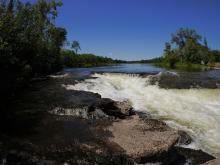
This challenging trail is a must-try for die-hard hikers with their own personal hiking bucket list. There are several nice lookout spots along the way, like Juniper Ridge Lookout, Red Arrow Rock Lookout and Manitou Mountain Lookout. After your hike head back to Calabogie to refuel with a hearty meal from On the Rocks or Canthooks Restaurant.
Do the Manitou Mountain, Eagles Nest and Juniper Ridge Lookout Hike for a five-hour loop that travels more than 15 kilometres. This route would be considered “hard with a total change in elevation of almost 600 metres.
Circuit of 5 Viewpoints - Haliburton Highlands
Difficulty: Moderate to Difficult
Length: 5.3 km
Elevation: 234 m
Time: 1.75 hrs
This is a great trail to use if you want some privacy as it’s not as highly frequented as some other trails mentioned in this series. Pay attention to markers to make sure you stay on the trail. Expect to encounter some portions of the trail which would fall in the “difficult” category as opposed to moderate.
You will want to bring extra water for this one – and bug spray!
Abes & Essens Trail – Lennox & Addington
Difficulty: Moderate
Length: 13.7 km
Elevation: 331 m
Time: 3.5 hrs
This trail is located at Bon Echo Provincial Park and is only one of many phenomenal trails on site (another one is mentioned below). This would be a good trail to try when camping at the park, but you can also access for day use. Expect to encounter uneven ground on this route so plan your footwear accordingly.
You must pay a day use fee to enter Bon Echo Provincial Park to access this trail.
Clifftop Trail - Lennox & Addington
Difficulty: Moderate
Length: 1.6 km
Elevation: 131 m
Time: 45 min
This out-and-back trail is short but has a sweet ending with a phenomenal view from a viewing platform. You will need to canoe or kayak to access the trailhead when the ferry is not operating, but the extra steps will be worth the effort. Expect some challenging staircases from the dock until you reach more level ground.
You must pay a day use fee to enter Bon Echo Provincial Park to access this trail.
The dock where you must tie up your boat can be quite busy so try and go off-peak times like on a weekday.
Blueberry Mountain - Lanark County
Difficulty: Moderate
Length: 4.5 km
Elevation: 145 m
Time: 1 hr
Part of the Mississippi Madawaska Land Trust, this trail is relatively flat and wide enough for several people to walk abreast until approximately four kilometres before you being the steep climb to the lookout. The trail takes you past beaver ponds, a scenic waterfall, and other nature spots that will make the effort worthwhile. If you aren't keen on the climb at the end, you can easily turn around after taking a rest on the conveniently located park bench at the foot of the uphill portion.
Dogs are permitted on the trail but must be kept leashed.
Bring plenty of water; after the climb at the end, you will need it.
Crotch Lake Lookout - North Frontenac
Difficulty: Moderate
Length: 3.5 km
Elevation: 61 m
Time: 1 hr
This out-and-back trail takes only about an hour to explore and is a good spot for birding. While the classification for the trail is moderate, it may be slightly lower on the difficulty scale depending on the skills of the hiker.
A road permit is required from the North Frontenac Parklands.
Cell service is patchy here so it’s advisable to download a trail map before leaving home.
Gun Mountain Loop Trail - Ottawa Valley
Difficulty: Moderate
Length: 4.3 km
Elevation: 151 m
Time: 1.5 hr
This trail is part of the Thomas P. Murray Recreation trail system and is worth the effort. The two kilometres of the trail has a 150 m elevation change to warm you up for the reset of the loop. The trail will take you to Tom's Lookout, and a phenomenal view. The lookout would make a great spot for a picnic and there are two Adirondack chairs there that will invite you to take a load off for a few minutes before continuing.
Dogs must be leashed on this trail.
Thomas P. Murray Recreation trails are open year round and make an excellent place for a winter snowshoe trek.
Rose Hill Nature Reserve – Lennox & Addington
Difficulty: Moderate
Length: 8 km
Elevation: 14 m
Time: 2 hr
This trail is part of the Mississippi Madawaska Land Trust, dedicated to conserving wilderness properties in Eastern Ontario. The total area of the Rose Hill Nature Reserve is almost 400 acres, and there are 2 kilometres of marked trails on the property. The Hemlock Trail is part of this trail system and is home to a beautiful hemlock stand.
Visitors are reminded to leave no trace and not to remove any flora or fauna.
Please follow the trail markers as the trail route may be redirected at times.
Crests of Kennisis - Haliburton Highlands
Difficulty: Moderate ++
Length: 3.9 km
Elevation: 217 m
Time: 2 hr
This trail is a perfect one if you're really looking to work up a sweat! With a more than 200 metre change in elevation you will be good and tired at the end. This trail is part of the longer Circuit of 5 Viewpoints (mentioned above) and you can combine them if you want a little more of a challenge and a longer route (roughly 6 km). Hikers have indicated the trail is more midway between "moderate" and "hard" so keep that in mind when setting out.
Pack some extra water and a snack for this one as it is more challenging than you might expect.
Bonus:
Sharbot Lake Ridge Trail - North Frontenac
Difficulty: Moderate
Length: .5 km
Elevation: 13 m
Time: 10 mins
You will be thankful this steep and intense out-and-back trail is so short! The rating for this one is “moderate” but that’s mostly due to its short length than the effort needed to complete it.
You will need to pay a fee to access Sharbot Lake Provincial Park.